Activity guide / Construction, Facilities & Technical
3D Laser Scanning & Model Production business setup in the UAE
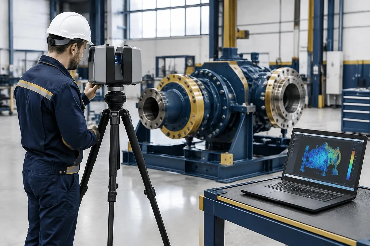
A terrestrial scanning assignment captures the geometry of an object or accessible environment and converts it into a usable digital record.
Plan this activityBy Two Pillars Advisory. Sources last checked 2026-10-27. Independent guidance, not authority advice.
Understanding 3d laser scanning & model production
A terrestrial scanning assignment captures the geometry of an object or accessible environment and converts it into a usable digital record. The operator must agree the required accuracy, coverage and deliverable format before gathering points; a visually convincing model is not necessarily suitable for measurement. This service can supply inputs to a separately qualified design team, preserve a condition record or document a manufactured component. It does not by itself confer cadastral surveying, engineering certification or aerial-operation permission. The inspected source supports capture and digital-model production. Site access, sensitive locations and the client’s acceptance specification remain assignment-specific checks, rather than automatic rights attached to the company address.
Scope review: Meydan published capture/model scope only; no cadastral surveying, engineering certification, tender access or drone permission inferred. Current site access and issuer wording require confirmation. Two Pillars Advisory FZCO is an independent business formation consultancy, not the issuer or a provider of every specialist activity described.
Asset geometry
Capture accessible objects to a defined accuracy and coordinate convention.
Building record
Document coverage and occlusions without claiming cadastral or structural certification.
Model handover
Supply validated digital inputs to a separately qualified engineering team.
At a glance
- What the activity covers: A terrestrial scanning assignment captures the geometry of an object or accessible environment and converts it into a usable digital record.
- Activity type: Specialist services
- Likely jurisdiction context: Depends
- Possible external approvals: Meydan published capture/model scope only; no cadastral surveying, engineering certification, tender access or drone permission inferred. Current site access and issuer wording require confirmation.
What you offer matters.
What this activity covers
A terrestrial scanning assignment captures the geometry of an object or accessible environment and converts it into a usable digital record.
A plain-English label, not an official activity name or code.
Boundaries & approvals to check
A visually persuasive point cloud is not a certified measurement or structural safety opinion. No drone operation is established.
Your independent consultant: Two Pillars Advisory
Two Pillars helps you define the business model, compare routes and prepare an application. We are an independent consultancy, not a licensing authority.
The licence issuer / regulator: the competent authority
The competent licensing authority decides the permitted activity scope and issues the licence. A sector regulator may separately assess and authorise regulated services. Neither decision is made by TPA.
Choose around your operations.
Terrestrial capture and model production only; site, cadastral, engineering and aviation permissions are not inferred.
For 3d laser scanning & model production: Meydan published capture/model scope only; no cadastral surveying, engineering certification, tender access or drone permission inferred. Current site access and issuer wording require confirmation.
Confirm the local operating route
Describe where customers, staff, premises and goods will be located. Ask the mainland issuer and any proposed free zone to confirm the exact scope and any permissions for operating outside the zone.
Map delivery across borders
Describe where the service is delivered or goods move. Confirm entity scope, destination requirements and any UAE local operations separately; international customers do not establish free zone eligibility.
Check the sector perimeter first
Describe the actual service, product and client type to the competent regulator. A commercial registration alone does not establish authorisation to deliver regulated services.
| Decision point | Mainland | Free Zone | Sectoral approvals |
|---|---|---|---|
| Who decides? | Competent emirate licensing authority | Proposed free zone licensing authority | Competent regulator, where applicable |
| Permitted operating scope | Requires case-by-case confirmation | Requires case-by-case confirmation | Meydan published capture/model scope only; no cadastral surveying, engineering certification, tender access or drone permission inferred. Current site access and issuer wording require confirmation. |
| Premises, people & documents | Confirm for the selected activity | Confirm for the selected activity and zone | Confirm against the regulated service or product |
| Fees & timing | Obtain a current itemised quotation | Obtain a current itemised quotation | Confirm if a separate application applies |
From scope to application.
- Agree accuracy, coordinate assumptions, coverage and deliverable formats before surveying the scene.
- Confirm terrestrial capture/model-production wording and site-access permissions.
- Prepare equipment checks, control references and a safe capture plan for each location.
- Record data gaps and limitations and hand models to separately qualified professionals where certification is required.
Illustrative planning sequence; the authority may require a different application order or additional steps.
Prepare the evidence. Price the scope.
A preparation checklist to discuss with the relevant authority — not a mandatory document list. Requirements and costs remain to be confirmed for your chosen route.
Conditional document checklist
Accuracy and reliance brief
Agree intended use, acceptance tolerance, coordinates and file formats.
Capture/access plan
Resolve site consent, safety, control references and sensitive-location restrictions.
Validation and gap record
Prepare equipment checks, coverage gaps and handover limitations for the client.
Line-item budget questions
Scope and site review
Confirm issuer and project-access requirements before quoting capture.
Equipment and processing
Quote calibration, capture and modelling against the actual accuracy and coverage.
Qualified reliance review
If required, price separate engineering or surveying acceptance rather than bundling certification.
Review the official references before committing to an applicationCommon mistakes worth avoiding.
- Presenting an unvalidated point cloud as a certified engineering or cadastral survey.
- Adding drone capture to a terrestrial proposal without separate current aviation permission.
Authority information, independently explained.
Published by Two Pillars Advisory. References last checked 2026-10-27; each source’s check date and jurisdiction are shown below. Review is limited to the cited activity scope, not an approval or universal licensing assessment. Confirm current requirements directly before applying.
No affiliation, partnership or endorsement by the authorities listed.
- Meydan Free Zone: 3D Laser Scanning & Model Production — inspected scope. Technical capture of objects, buildings or environments using LiDAR or structured light, producing point clouds, 3D models and digital twins. Uses include BIM inputs, as-built records, quality checks, heritage documentation and reverse-engineering inputs. Boundaries: The body distinguishes this service from general surveying and photography; it does not establish cadastral or statutory surveying authority. Scan/model delivery is not permission to sign engineering designs or certify structural adequacy. No drone/aerial operation permission is supplied; do not add that method by inference. (Meydan Free Zone published scope, Dubai only, checked 2026-10-27)
- Invest in Dubai: Search business activities. Official Dubai activity search. Final activity wording and code must be confirmed here or with the licensing authority before filing. (Dubai, checked 2026-09-12)
- Dubai Department of Economy and Tourism (DET): Business licensing. Official Dubai business licensing information, including licence types and permit requirements. (Dubai, checked 2026-09-12)
Before you take the next step.
Does scanning include engineering certification?
No. Geometry capture and model delivery do not establish authority to sign engineering designs or structural adequacy reports.
Can drones be used?
No aerial permission is established here. The commercial UAS suspension remains a separate regulatory hold unless a current revocation is verified.
What should the client specify?
Required accuracy, coordinate system, occluded areas, file formats and intended reliance should be agreed. A model suitable for visualisation may not satisfy design or measurement requirements.
Ask Two Pillars to confirm 3D Laser Scanning & Model Production